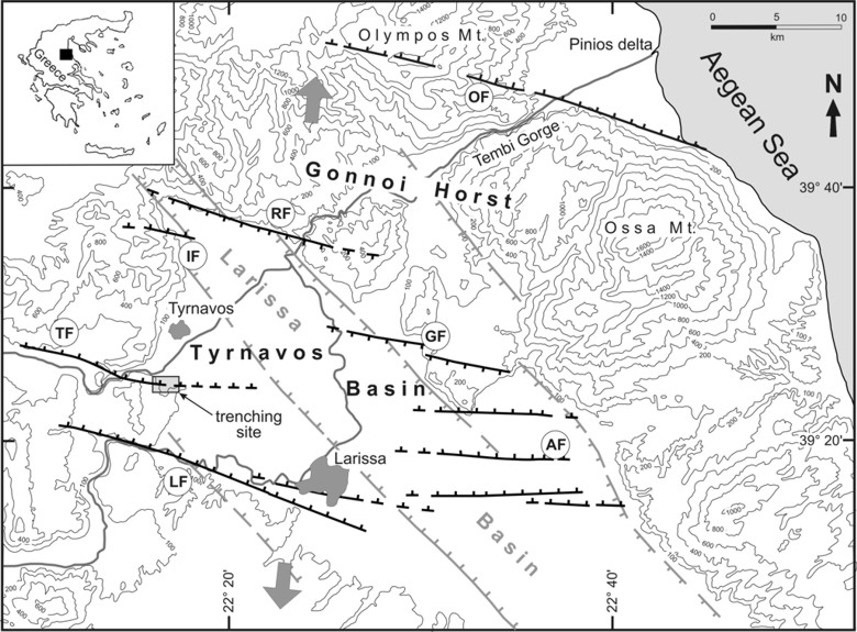
Simplified tectonic map of eastern Thessaly. Black lines: active structures affecting the area since Middle Pleistocene associated to the E-W trending Tyrnavos Basin. Grey lines: major Pliocene-Early Pleistocene faults bordering Larissa Basin. Barbs on the downthrown side of the faults. TF = Tyrnavos Fault; RF = Rodia Fault; IF = Ligaria Fault; GF = Gyrtoni Fault; LF = Larissa Fault; AF = Asmaki Fault; OF = Omolio Fault. Large grey arrows represent the active stress field affecting the area (Caputo, 1990).
[from Caputo et al. (2004)].
|