
| DISS 3.2.GreDaSS: Seismogenic Source GRCS002 - North Tyrnavos Basin | |
| Source Info Summary | Commentary | Pictures | References |
|
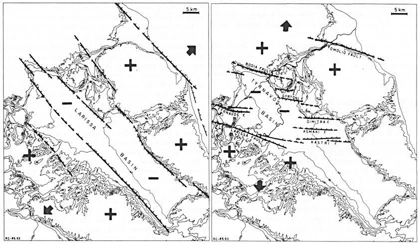
Simplified structural map of eastern Thessaly showing the major normal faults activated during the Pliocene-Early Pleistocene (left) and Middle Pleistocene-Holocene (right) extensional regimes which generated the NW-SE and E-W trending Larissa and Tyrnavos basins, respectively.
[from Caputo et al. (1994)].
|
 |