
| DISS 3.2.GreDaSS: Seismogenic Source GRCS070 - Amyndeo | |
| Source Info Summary | Commentary | Pictures | References |
|
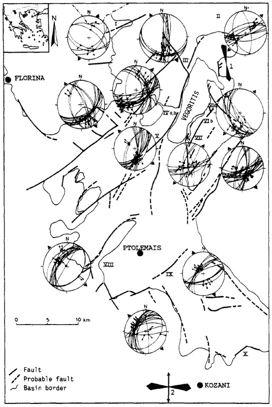
Neotectonic map of the area studied, including the sites of field observations, the equal-area projections of measured striated faults and the resulting directions of extension indicated by arrows. Large black arrows (sites 1 and 2) show the orientations of the minimum principal horizontal stress after in situ measurements.
[from Pavlides and Mountrakis (1987)].
|
 |