
| DISS 3.2.GreDaSS: Seismogenic Source GRCS070 - Amyndeo | |
| Source Info Summary | Commentary | Pictures | References |
|
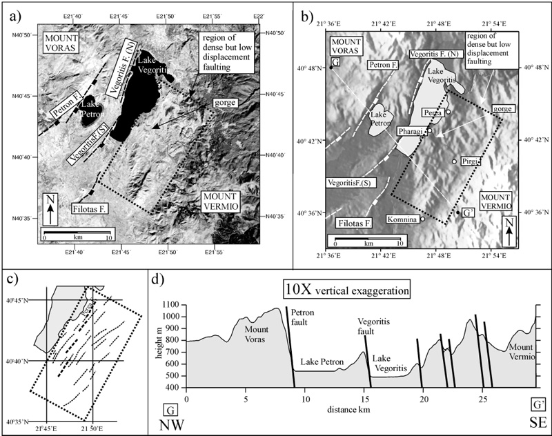
(a) Landsat TM image of part of the Ptolemais–Florina basin of NW Macedonia, showing the location of the Petron and Vegoritis faults and the complexly faulted region around Perea (black dotted box). (b) Digital topographic image of the same region as in (a), illuminated from the west. (c) Fault map of the Perea region (delimited by box in (a and b). Topographic profile across the fault array.
[from Goldsworthy and Jackson (2000)].
|
 |