
| DISS 3.2.GreDaSS: Seismogenic Source GRCS070 - Amyndeo | |
| Source Info Summary | Commentary | Pictures | References |
|
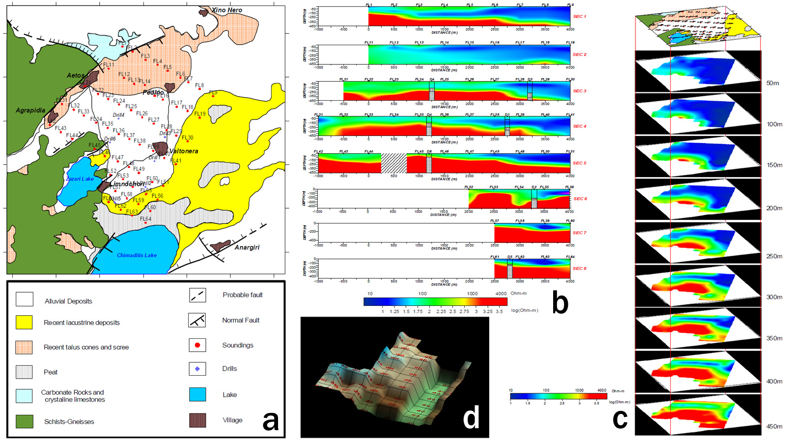
a) Simplified map showing the VES centres and the main geological formations in the area
of study.
b) Pseudo-2D subsurface resistivity sections of the NW-SE sections SEC1-SEC8.
c) Interpreted resistivity results presented in a 3D layout as depth slices from a relative depth
of 50 m to 450 m.
d) 3-D image of the surveyed area depicting the relative depths of the geological
background.
[from Atzemoglou et al. (2003)].
|
 |