DISS 3.2.GreDaSS: Seismogenic Source GRCS070 - Amyndeo
Source Info Summary
Commentary
Pictures
References
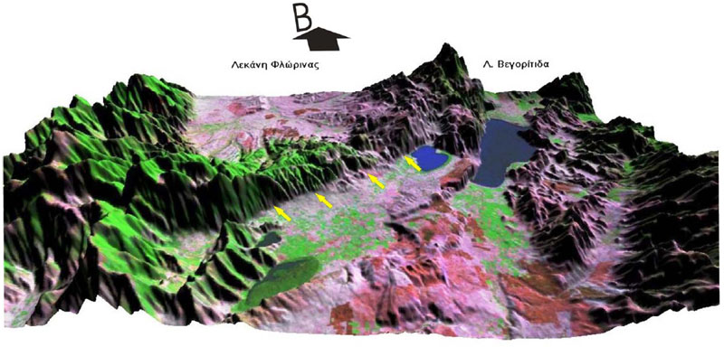
Figure 12 - DEM and Landsat 7 image of the fault zone
DEM with the use of Landsat 7 image showing the fault scarp. [from Xanthopoulou (2006)].