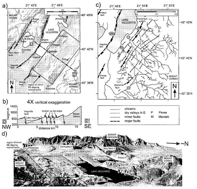
(a) Illuminated topographic image of part of the Ptolemais-Florina basin ofNWMacedonia, showing the location of the Petron and Vegoritis faults and the complexly faulted region around Perea. (b) Topographic profile across the densely faulted region showing the closely spaced small faults of the Perea region dissecting a possible older dip slope. (c) Drainage map of the Perea region, showing the two main stream networks S1 and S2, the faults, and the dry valleys A-G. (d) Perspective view of the Landsat TM image overlain on the digital topography in the Ptolemais-Florina basin.
[from Goldsworthy and Jakson (2001)].
|