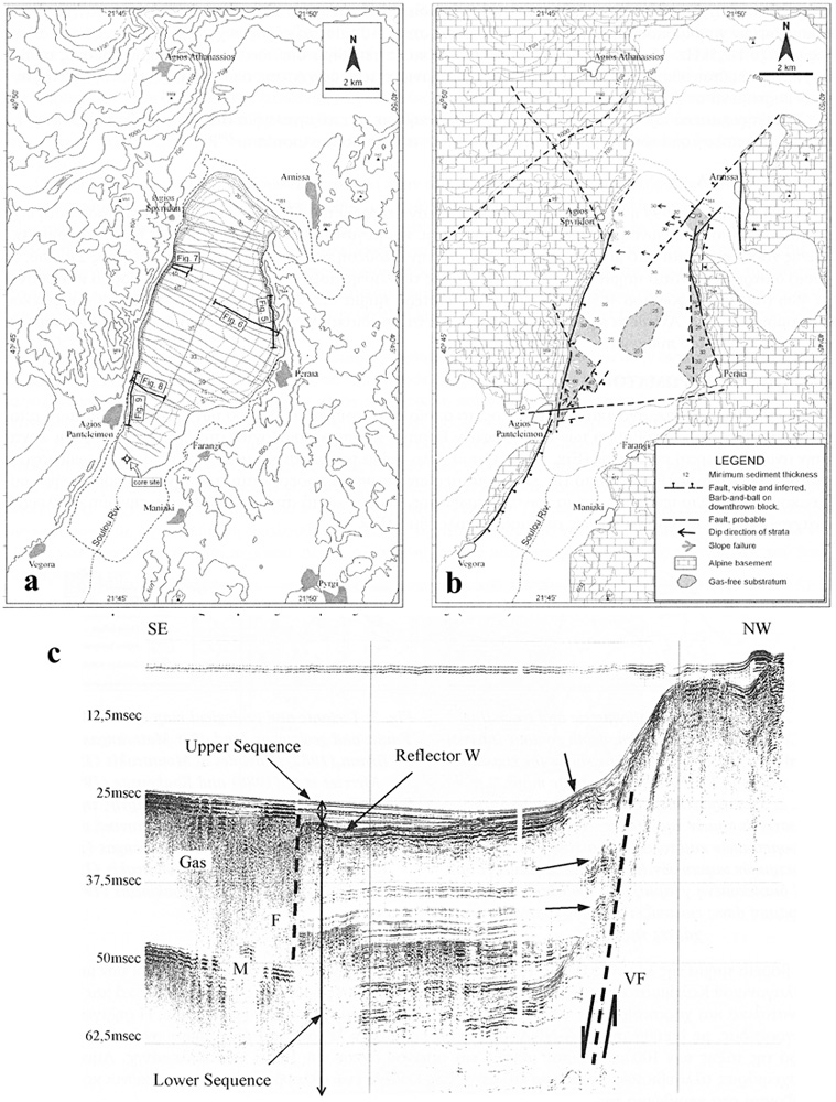
a) Topographical, bathymetric and track line map. Contour interval is 100 m, depth contour interval (dotted lines) is 5 m. Dashed line shows the coastline shown in the HAGS topographic maps.
b) Tectonic and geological map of Lake Vegoritis. Faults and geology on land after Matarangas (1981), Brunn (1982), Pavlides and Mountrakis (1987), Mercier et al. (1988) and Koukouzas (1997).
c) BOOMER 175J seismic profile showing the western slope of the lake off Agios Panteleimon village. Note the inferred plain of Vegoritis fault and the slumping phenomena indicated by small arrows. A secondary synthetic fault (F) controls the mobilisation of organic gas within the sediments. M: multiple. For location see
map (a) (refering to fig. 8).
[from Sakellariou et al. (2001)].
|