
| DISS 3.2.GreDaSS: Seismogenic Source GRCS077 - Komanos | |
| Source Info Summary | Commentary | Pictures | References |
|
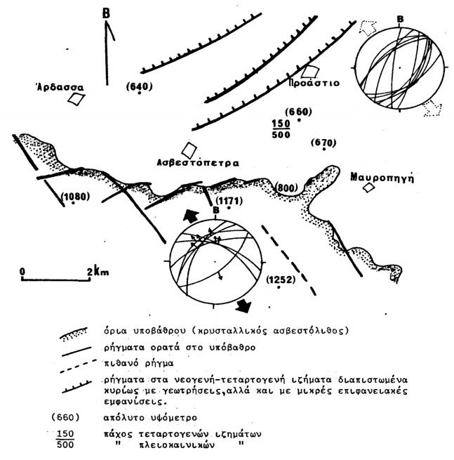
Neotectonic sketch map of the Asvestopetra area (south of Ptolemaida). The faults in the basement (continued lines) and in the basin (barbed lines) are shown. Stereoplots show the dip directions and dipping angles of fault planes. Slickensides from measurements on basement faults are represented with arrows and provide information for the stress field direction of the most recent phase: N-S to NNW-SSE.
[from Pavlides (1985)].
|
 |