
| DISS 3.2.GreDaSS: Seismogenic Source GRCS077 - Komanos | |
| Source Info Summary | Commentary | Pictures | References |
|
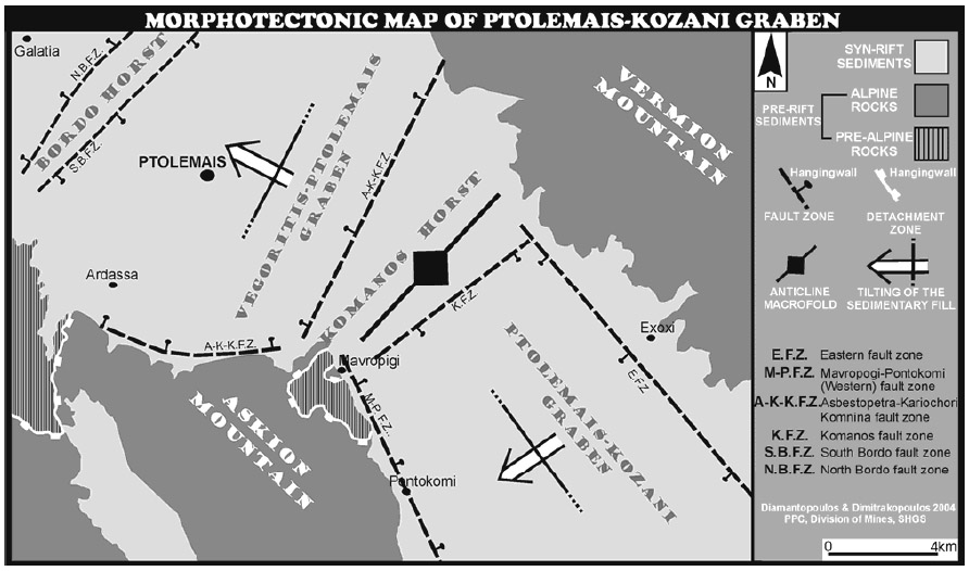
Morphotectonic map of Ptolemais-Kozani graben, modified after Diamantopoulos et al., 2004. In parallel, they are illustrated the main morphotectonic units and the major fault zones. Note also the sub-surface mega-anticline macrostructure of Komanos Horst, which essentially coincides with the region of the major ductile-brittle macrostructures.
[from Diamantopoulos and Dimitrakopoulos (2004)].
|
 |