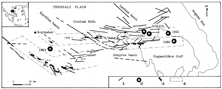
South Thessaly fault pattern showing faults (1), epicentres of mainshocks from recent earthquakes (2), coseismic fault ruptures (3) and areas of possible seismogenic fault zones activated during the 1954 (Sophades), 1955 (Volos), 1957 (Velestino) and 1980 (Volos) earthquakes (4). Data from Papazachos et al. (1983), Papastamatiou & Mouyaris (1986a, b), Ambraseys & Jackson (1990), Caputo (1990), Caputo & Pavlides (1991) and new field and remote sensing observations. Inset map shows position in mainland Greece.
[from Papazachos et al. (1983)].
|