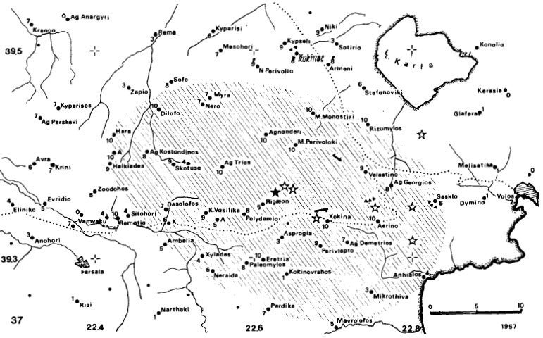
General map of the area affected by the 8th March 1957, Velestino earthquakes (Ms=6.5 and 6.6) (1) Sites for which information is sufficient to estimate intensity. (2) Sites with insufficient macroseismic data to assess intensity. (3) Sites where the shock was not felt. (4) Small settlements, monasteries, farming communities (mostly abandoned today) affected by the shock. (5) Submarine cable-breaks associated with earthquake. (6) Areas of landslides, rockfalls and unspecified ground deformations associated with event. Full triangles indicate large scale effects. (7) Sites of reported ground liquefaction, slumping of level ground and flow slides. (8) Coseismic elevation on subsidence of coast. (9) Estimated epicentre of main shock. (10) Adopted macroseismic location of aftershock. (11) Seismic sea-wave associates with event. (12) Ground deformations of tectonic origin. (13) Number indicates proportion of houses (in tenths of total number exposed to the earthquake) which were totally destroyed or damaged beyond repair. 0 indicates 1-9 per cent of total ruined. A bar implies 0 per cent losses. (14) Railway lines. Shading shows extend of epicentral area deduced from maximum damage effects. Scale is in kilometres.
[from Ambraseys and Jackson (1990)].
|