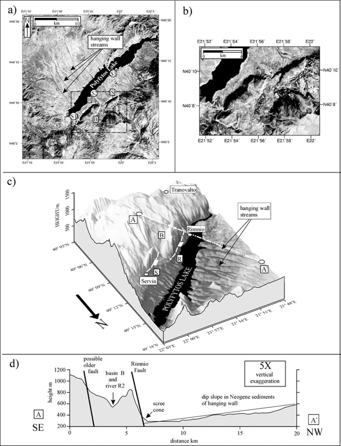
(a) Landsat TM image of the Aliakmon valley south of Kozani, showing the location of the Rymnio (R) and Servia (S) fault segments and the major drainage systems S1, S2 and S3. (b) Enlarged unmarked Landsat TM image of the fault zone (see box in a). (c) Perspective view of the topography in the Rimnio-Servia region (illuminated from the east), showing the location of the faults and footwall basin (B). (d) Topographic profile across the middle of the Rimnio fault segment.
[from Goldworthy and Jackson (2000)].
|