
| DISS 3.2.GreDaSS: Seismogenic Source GRIS111 - West Stratoni Fault | |
| Source Info Summary | Commentary | Pictures | References |
|
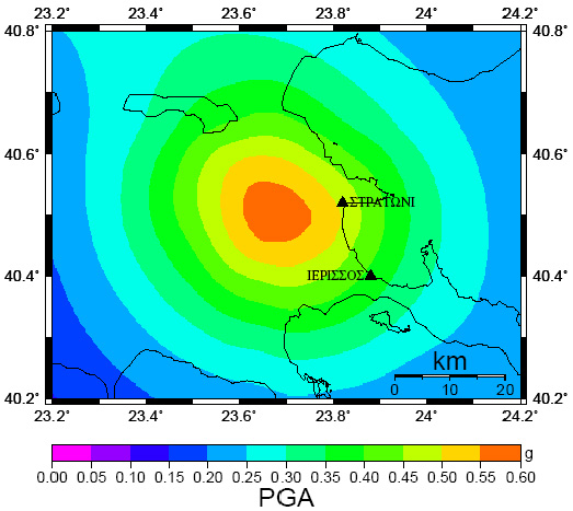
SHA map of the study area showing a 10% probability of exceeding the ground acceleration value at least once for the next 50 years.
[from Pavlides et al. (2010)].
|
 |