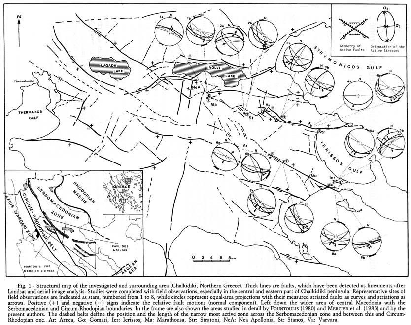
Structural of Chalkidiki and surrounding area. Thick lines are faults which have been detected as lineaments after Landsat and aerial image analysis and then completed with field observations. Representative sites of tectonic field observations are indicated as stars (1-8) and are accompanied with equal-area projections. The (+) and (-) symbols are for relative fault motions Ar: Arnea, Go: Gomati, Ier: Ierissos (in this paper, "Ierissos fault" is named a different fault, near Gomati, and is irrelevant with the Ierissos SA), Ma: Marathousa, Str: Stratoni, NeA: Nea Apollonia, St: Stanos, Va: Varvara (this is also a different fault from the Barbara fault described in Ierissos SA).
[from Pavlides and Kilias (1987)].
|