
| GreDaSS_2.0: Seismogenic Source GRIS112 - East Stratoni Fault | |
| Source Info Summary | Commentary | Pictures | References |
|
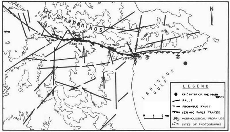
A structural map of SE Chalkidiki peninsula (Ierissos-Stratoni region) showing the main seismic rupture of the 1932
earthquake, as well as the fault pattern of the wider area (heavy lines).
[from Pavlides and Tranos (1991)].
|
 |