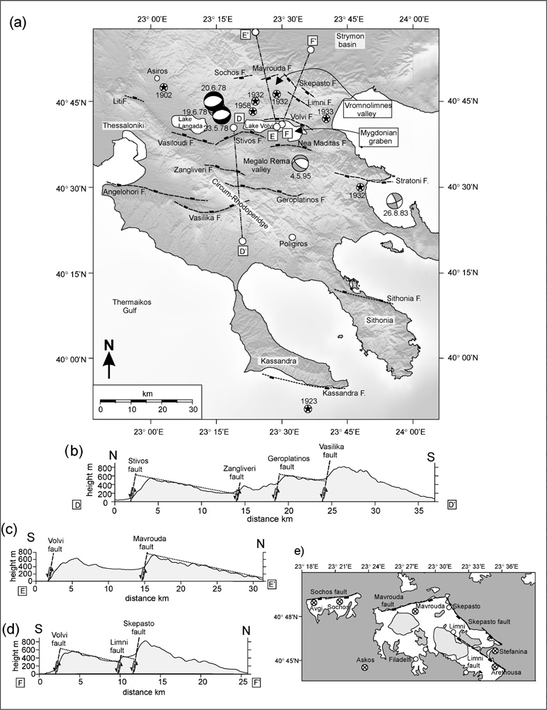
(a) Major faults and earthquakes in the Chalkidiki region. (b) Topographic profile across the Stivos, Zangliveri, Geroplatinos and Vasilika faults. (c) Topographic profile across the Volvi and Mavrouda faults. (d) Topographic profile across the Volvi, Limni and Skepasto faults. (e) Geology map of the Vromnolimnes valley showing the location of the drained lakes (light grey) and villages affected by the September 1932 earthquake (crossed). Medium grey colour is Paleozoic-Mesozoic rocks, white colour is young river and valley deposits..
[from Goldsworthy et al. (2002)].
|