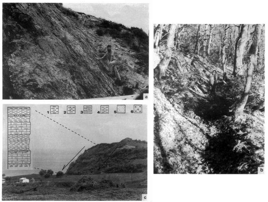
(a) Outcrop photograph showing the exposed surface of the Stratoni Fault at the village Stagira, affecting the basement rocks. The slickenside is 3 m high and partly covered by scree. The earthquake of 1932 activated this part of the fault and caused a vertical displacement of the Holocene deposits of about 2 m and a heave of more than 0.5 m, although these dimensions have been probably enlarged by shaking and gravitational forces. (b) A remnant coseismic furrow, extending in 500 m along the neotectonic fault affecting basement rocks (schists, amphibolites, etc.). (c) An antithetic fault of the hangingwall block south of Ierissos town affecting Pliocene marls and limestones. The lithostratigraphic column is also shown (1, muds; 2, marls; 3, marly limestones; 4, silts-silty sands; 5, sands; 6, pebbly sands).
[from Pavlides and Tranos (1991)].
|